
Light Detection and Ranging (LiDAR) is an active sensor which uses electromagnetic waves in the optical and infrared wavelengths. This post will discuss about what is Light Detection and Ranging (LiDAR), it’s types, architecture, how it works, applications, advantages and disadvantages.
What is LiDAR (Light Detection and Ranging)
Light Detection and Ranging (called as LiDAR in short) is used as a Range Finder or tracking device that uses light in the form of Laser. It consists of a laser source, sensor and Global Positioning System (GPS) receiver. Laser pulses are directed towards the Earth’s surface and the light pulses are reflected back to the sensor.
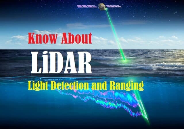
Fig. 1 – Introduction to Light Detection and Ranging (Li-DAR)
Light Detection and Ranging operates on both terrestrial platform and aerial platform. However, this post emphasizes on its operation from aerial platform i.e. using spacecraft like satellite or aircraft like helicopter, airplanes, drones etc. It is helpful in making 3-D representations of the target area.

Fig. 2 – 3-D Image using Light Detection and Ranging (Li-DAR)
Types of LiDAR (Light Detection and Ranging)
There are two types of Li-DAR, namely:
- Airborne Light Detection and Ranging
- Terrestrial Light Detection and Ranging
Airborne LiDAR
As the name suggests, Airborne LiDAR operates laser scanning from an Aircraft, Spacecraft, Helicopter or Drones.
It is categorized into two types:
- Topographic Light Detection and Ranging
- Bathymetric Light Detection and Ranging
Topographic LiDAR
It uses near-infrared light to generate Topographic maps of the scanned area.
Bathymetric Lidar
It scans through water and mainly used to gather information of hydrographic data. It is used for coastal and inland water projects.
Terrestrial LiDAR
It is used for scanning on the earth’s surface and performs High Definition surveying. It is also used in Digital Terrain Models.
It is categorized into two types:
- Mobile Lidar
- Static Lidar
Mobile Lidar
The system is mounted on moving vehicles on land like cars and trains.
Static Lidar
This type of system is fixed on an immovable tripod.
Architecture of LiDAR (Light Detection and Ranging)
The components include:
- Transmitter
- Receiver
- Optical System
- Control and Processing Unit

Fig. 3 – Schematic Diagram of LiDAR Architecture
Fig. 3 above shows the Architecture of Light Detection and Ranging (LiDAR) System. Mostly the system uses diode laser or diode-pumped solid-state laser to transmit the light pulse. Diode Lasers have broad beam and are inexpensive. Transmitter Optics helps the system to focus the light on to the target area. Some of the light reflects off the objects like buildings, trees etc.
The Reflected light or the back scattered light is focused into the Photo-detector. Light Detection and Ranging (LiDAR) Receiver can be a single detector or an array of detectors. The photo-detector is connected to Control and Data Acquisition unit that measures the amount of back scattered light as a function of distance.
Transmitter
It helps in transmitting the Laser light in the form of pulses.
Receiver
It receives the reflected light or back scattered light.
Optical system
The Optical System in the Transmitter helps to focus the light on the target area and Receiver Optical system helps to focus the reflected light into Photo-detector.
Control and Processing Unit
This unit receives the reflected light and processes the Data using specialized software’s. This unit has:
- GPS Receiver
- IMU (Inertial Measurement Unit)
GPS Receiver
Aircraft’s onboard GPS Receiver determines the aircraft’s position in terms of latitude, longitude and altitude with the help of Sensor.
IMU (Inertial Measurement Unit)
Inertial Measurement Unit referred as IMU is responsible for the orientation of an aircraft or aerospace vehicle with respect to an inertial frame of reference such as the celestial sphere. It helps in determining the attitude of the aircraft when the sensor is taking measurements continually. Horizontal and vertical position of the aircraft helps the system to transmit laser pulses effectively.
How does LiDAR (Light Detection and Ranging) Work
Light Detection and Ranging (LiDAR) device is mounted on aircraft or spacecraft and as it flies over the ground, laser pulses are directed towards the Earth’s surface. The light travels fast to the earth’s surface, reflecting off Photons from obstacles like buildings, mountains, trees etc. The reflected light (Photons) reaches the LiDAR Sensor and Receiver records the time delay between the emission of the light pulse and the detection of the reflected signal also called as “Echoâ€. The Receiver records repeated measurements of the reflected signal.
The Light which reflects from the earth’s surface is in the form of a wave. Peak detection of this Waveform is a prerequisite for further processing. The areas on the earth which reflects more Photons are referred as “Peak Points†or “Peaksâ€.

Fig. 4 – (a) Representation of Pulse Measurement Principle (b) Block Diagram of LiDAR System
With the help of GPS Receiver and IMU (Inertial Measurement Unit) , the angular orientation of the sensor with respect to target area is measured and “Range Distance†between the sensor and target area is calculated by the Receiver and records the x, y, z coordinates of each pulse which helps the system to correct the aircraft’s position which helps in generating output accurately.
Millions of recorded data points are generated by the system. System Control and Data Acquisition unit helps in processing of “Point Cloud†of x, y, z data coordinates with the help of computer interface. Data is analysed and processed to obtain Digital Surface Model of the target area.
Few systems use iterative algorithms, scan-matching algorithms for “Point Cloud†matching. Some of the systems use “LiDAR Odometry and Mapping method (LOAM)†which offers accurate mapping in Real-Time.
Pulse Laser Measurement Principle is explained below:

Applications of LiDAR
The applications of Light Detection and Ranging (Li-DAR) include:
- Advanced Surveying like survey of Dams and Reservoirs, topography of land surveying has become easier with this technology.
- This technology is widely used by the Military to generate 3-D Maps.
- It is also used in Archaeology, Geology, Agriculture, Mining etc.
- It is also used in Contour Mapping which is helpful in estimating surface elevations, shows steep valleys and hills.
- It is extensively used in Space exploration programs.
- Atmospheric study has become easy with this technology.
- Virtual Reality Scans has helped Navy engineers to create Virtual Ship environment which is used for training and testing purposes.
- This technology is used for wildlife habitat analysis.
Advantages of LiDAR
The advantages of Light Detection and Ranging (Li-DAR) include:
- It offers wide detection range.
- Data acquisition is accurate and precise.
- Temperature stability of the system is high.
- It can be operated during day and night.
- Data is error free and precise.
- Operates at high speed.
- Data Density is high i.e. it uses 1,67,000 pulses per second.
Disadvantages of LiDAR
The disadvantages of Light Detection and Ranging (Li-DAR) are:
- Operating cost is high.
- Penetration of LiDAR pulses in densely vegetated areas is not adequate.
- Processing of LiDAR data requires specialized software.
Also Read:
Global Positioning System (GPS) - Architecture, Applications, Advantages
What is Li-Fi Technology - How it Works, Applications & Advantages
How Electronic Voting (e-Voting) Works - Types, Application & Advantages
Thanks for sharing. I read many of your blog posts, cool, your blog is very good.
lvctea
Embark into the epic galaxy of EVE Online. Find your fleet today. Create alongside thousands of players worldwide. [url=https://www.eveonline.com/signup?invc=46758c20-63e3-4816-aa0e-f91cff26ade4]Free registration[/url]
Usually I don’t read article on blogs, but I would like to say that this write-up very forced me to try and do it! Your writing style has been surprised me. Thanks, very nice article.
Hey there! I’ve been reading your website for some time now and finally got the bravery to go ahead and give you a shout out from Dallas Tx! Just wanted to say keep up the good work!
Hello! I could have sworn I’ve been to this blog before but after browsing through some of the post I realized it’s new to me. Anyways, I’m definitely happy I found it and I’ll be book-marking and checking back frequently!
I haven¦t checked in here for a while since I thought it was getting boring, but the last several posts are good quality so I guess I will add you back to my daily bloglist. You deserve it my friend 🙂
Great post. I am facing a couple of these problems.
excellent points altogether, you simply gained a brand new reader. What would you recommend in regards to your post that you made a few days ago? Any positive?
you’re really a good webmaster. The site loading speed is incredible. It seems that you are doing any unique trick. Also, The contents are masterpiece. you have done a wonderful job on this topic!
Keep up the fantastic work, I read few articles on this site and I think that your weblog is very interesting and has lots of fantastic info .
You are my intake, I own few web logs and sometimes run out from post :). “No opera plot can be sensible, for people do not sing when they are feeling sensible.” by W. H. Auden.
very nice submit, i definitely love this website, keep on it
Pretty! This was a really wonderful post. Thank you for your provided information.
As I website owner I think the written content here is real wonderful, regards for your efforts.
Have you ever thought about publishing an ebook or guest authoring on other websites? I have a blog based upon on the same information you discuss and would really like to have you share some stories/information. I know my subscribers would appreciate your work. If you’re even remotely interested, feel free to send me an email.
Its good as your other blog posts : D, regards for putting up. “It takes less time to do things right than to explain why you did it wrong.” by Henry Wadsworth Longfellow.
Wonderful paintings! This is the type of information that are meant to be shared across the net. Disgrace on the seek engines for now not positioning this post higher! Come on over and talk over with my website . Thanks =)
Thanks for sharing. I read many of your blog posts, cool, your blog is very good.
non profit bill consolidation [url=https://otvetnow.ru]https://otvetnow.ru[/url] vacation property management software
Excellent read, I just passed this onto a friend who was doing a little research on that. And he just bought me lunch as I found it for him smile Thus let me rephrase that: Thank you for lunch! “Feeling passionate about something is like getting a peak at your soul smiling back at you.” by Amanda Medinger.
I’ve been exploring for a bit for any high quality articles or blog posts on this kind of space . Exploring in Yahoo I at last stumbled upon this website. Reading this info So i’m glad to show that I’ve an incredibly excellent uncanny feeling I found out exactly what I needed. I such a lot definitely will make sure to don’t forget this website and provides it a glance on a relentless basis.
Thanks a lot for sharing this with all of us you actually know what you are talking about! Bookmarked. Please also visit my site =). We could have a link exchange agreement between us!
What’s Taking place i am new to this, I stumbled upon this I’ve found It absolutely useful and it has helped me out loads. I am hoping to contribute & assist other customers like its aided me. Good job.
Hi there, just became aware of your blog through Google, and found that it is really informative. I am going to watch out for brussels. I’ll appreciate if you continue this in future. A lot of people will be benefited from your writing. Cheers!
Wow, fantastic blog layout! How long have you been blogging for? you made blogging look easy. The overall look of your web site is magnificent, let alone the content!
Some truly interesting info , well written and broadly user pleasant.
I really like your blog.. very nice colors & theme. Did you design this website yourself or did you hire someone to do it for you? Plz reply as I’m looking to create my own blog and would like to find out where u got this from. many thanks
r0bnu2
Hi there! Would you mind if I share your blog with my facebook group? There’s a lot of people that I think would really appreciate your content. Please let me know. Thank you
4i77ab
Hi there! This post couldn’t be written any better! Reading through this post reminds me of my previous room mate! He always kept talking about this. I will forward this article to him. Pretty sure he will have a good read. Thank you for sharing!
There’s noticeably a bundle to know about this. I assume you made certain good factors in options also.
I don’t think the title of your article matches the content lol. Just kidding, mainly because I had some doubts after reading the article.
6zrnlq
This blog is definitely rather handy since I’m at the moment creating an internet floral website – although I am only starting out therefore it’s really fairly small, nothing like this site. Can link to a few of the posts here as they are quite. Thanks much. Zoey Olsen
I don’t think the title of your article matches the content lol. Just kidding, mainly because I had some doubts after reading the article.
Your point of view caught my eye and was very interesting. Thanks. I have a question for you.