
Most of us use Global Positioning System (GPS) every single day. It has become an inseparable part of our life. Let it be Google Maps or any other GPS-based navigation system, we are heavily dependent on it. This post will discuss Global Positioning System, its architecture, how it works, future of GPS, applications, advantages and disadvantages.

In other words, GPS is a navigation system initially developed by the US department of defense for the assistance of military and soldiers. However, then introduced to the common man and is now become a part and parcel of everyone’s life for every requirement right from velocity, to location to timing.
What is Global Positioning System (GPS)
GPS is a positioning system that is based on a network of satellites that continuously transmit coded information through radio signals. Once the receiver receives the signals, the transmitted information is interpreted to find the location of the place on the earth accurately. It provides users with exact time, velocity, and location in all weather conditions, 24 by 7, and all around the globe.
")
Fig. 1 – Introduction to Global Positioning System (GPS)
This system is made up of around 29 satellites which are located nearly 20,000 km above the Earth’s surface and operate in all weather conditions. The GPS satellites travel in 6 earth-centered orbital planes at a speed of 14000 km per hour. This system is largely available in all parts of the world, 24 hours a day. The U.S. Department of Defence (USDoD) had originally put the satellites into orbit for military use but made them available for civilian use in the 1980s. During the gulf wars, the GPS was first used to combat war activities.
Global Positioning System (GPS) is also used for navigation in planes and ships. It helps military and civilian users have a critical advantage with continuous real-time and 3-dimensional positioning data.
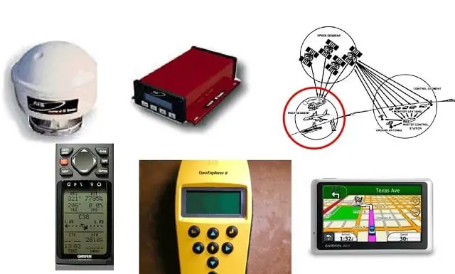
Global Positioning System (GPS) Architecture
The Architecture of the Global Positioning System consists of three segments or units namely:
- GPS Space Segment
- GPS Control Segment
- GPS Receiver (User) Segment

Fig. 2 – Global Positioning System (GPS) Architecture
1. Global Positioning System (GPS) Space Segment
Initially, the Space Unit comprised of 24 active satellites but now it has been upgraded to 32 satellites. They are assembled with huge solar panels with rechargeable batteries that act as a power source. The function of the satellites in space is to route or navigate the radio signals received from the control unit to store and re-transmit the message to the respective Receiver Unit.
 Space Segment")
GPS satellites typically fly in circular orbits. It flies as high as an altitude above 20 thousand km and at a period of twelve hours. The GPS satellite is so designed that they get adjusted themselves to face their solar panels towards the sun and the antennas also adjust accordingly towards the earth. The orbital planes are always centered on the earth. The orbit of this satellite is thoughtfully designed in a way that at least six satellites are placed in a line of sight from any place of location on the earth.
The GPS system is established in six orbitals and arranged in nearly circular orbits. These are placed at a height of 20200 km and at an orbital radius of 26600 km. The inclination to the equator is at 55 degrees. The revolution period of these satellites is 12 hours. The space segment is so designed for the GPS system to have at least 4 satellites at any moment during the entire year and to any part of the world for observation.
2. Global Positioning System (GPS) Control Segment
 Control Segment")
The Control Segment is the second component of the GPS. The Control Unit consists of several monitoring and control stations.
The GPS Control Segment is divided into the below-mentioned three sub-components:

- Monitor Station
- Master Control system
- Ground Antennas
Monitor Station
The monitor stations monitor the GPS satellite signals. The overall health of the orbital satellites is managed by the monitor station. It keeps a check on the speed, position, and exact latitude of the orbiting satellites. The control system also monitors that the clocks and the GPS do not exceed acceptable limits.
One monitor station is capable of tracking approximately 11 satellites at a single point in time. Every station checks the satellite twice a day and keeps the satellites in the performing stage.
Master Control Station
Monitor Station sends the GPS Satellite Signals to the master control station where operational specifications are checked and revised before transmitting the control signals through ground antennas back to the GPS satellites.
The Master control system for GPS is situated in Colorado Springs at Falcon Air Force base. The entire management of transmission sites and remote monitoring are carried out by the master control station. All six stations perform checkups of the GPS satellites twice a day as they complete their revolution around the earth.
To have an optimal GPS constellation, the master control is capable of repositioning the satellites. It also displays the speed information and the location to the users. The receiver typically has a number of channels that portray its capability to monitor the number of satellites simultaneously. At present, there are approximately channels between twelve and twenty.
The Master Control Stations to receive satellite signals are as under:
- Cape Canaveral
- Kwajalein
- Diego Garcia
- Ascension
- Hawaii
- Colorado (Prime station)
Ground Antennas
The satellites are tracked horizon to horizon with the help of ground Antennas. In case of any correction information to be transmitted to the individual satellites, that is also taken care of by ground antennas. One can conclude that the ground antennas are used for control and command purposes with the GPS satellites.
3. GPS User (Receiver) Segment
The User Unit is the term given to all GPS receivers like mobile phones, laptops, PC, or any other device. The device receives the signals from the GPS satellites and determines how far away it is from each satellite.
Every GPS receiver has three components as mentioned below:
- An Antenna that is typically tuned to the satellite for the transmission of frequency.
- Receiver processor.
- A clock that is highly stable is typically a crystal oscillator.
How does Global Positioning System (GPS) Work
The three elements of the Global Positioning System work in unison resulting in accurate and reliable operation of the positioning system. GPS positioning is based on “Trilateration Principle†which determines the position by measuring distances to points at known coordinates. Trilateration requires three ranges to three known points at a minimum but Global Positioning System requires four “Pseudoranges†to four satellites.
Hence the positioning system uses two main factors in determining the position:
- Position of the Receiver (User) using Trilateration Principle
- Pseudorange Calculation

Position of the Receiver (User) Using the Trilateration Principle
To calculate the 2-D position (latitude and longitude) of a point of interest or track movement, a GPS receiver must be locked on to the signal of at least three satellites. A single satellite tracks a general location of the point of interest on the Earth’s surface. This location information is spread over a large area.
Data from a second satellite, when added to this information, allows the Global Positioning System to narrow the location. This will be the point where the two areas of satellite data overlap. Adding data from a third satellite provides a more accurate position of the point.
The distance is measured using the equation:
Distance = Travel Time X Speed of Light
Where Travel Time is the time taken by the signals to reach the receiver, which travels at the speed of light and the distance measured helps to locate the point of interest (User) on the face of Earth.
The fourth satellite is used to re-confirm and enhance the position of the point of interest(Receiver). The receiver determines the 3-D position (latitude, longitude and altitude) of the point of interest with the information from the fourth satellite. Precision increases with increase in the number of satellites in the vicinity.

Fig. 3 – Trilateration Principle
Pseudorange Calculation
The GPS satellites which orbit the Earth twice a day transmit or broadcast signals on the same two frequencies called L1 and L2. The primary signal is broadcast on L1 and is modulated with two information signals called C/A (Coarse and Acquisition code) and P (for Precise code). This signal undergoes spread spectrum modulation technique that basically consists of a carrier signal that is repeatedly inverted having 180ᶿ phase shift. Replica of the Precise code is broadcast on the second frequency called L2.
In addition to transmitting a specific phase-change pattern, additional data is also added to the signal which comprises of the navigation message. This message has the information needed to calculate the current position of the satellite at the time of transmission.
The signal generator consisting of 10-bit shift registers generates the C/A code pattern which acts as the input to Exclusive–OR Gate. The resulting digital output is referred to as Pseudo-Random Number or PRN sequence.

Fig. 4 – Schematic Representation of Pseudorange Calculation
In order to receive the spread-spectrum signal, the Receiver must know the desired PRN sequence. The receiver searches for specific satellites by generating its own copy of the sequence and shifting the pattern that matches with the transmitted pattern. This is achieved using correlator, which generates an output that corresponds to the degree of match between the two signals.
Once the signals are matched, the Receiver computes the distance to each satellite using time frames, called “Pseudorangeâ€. The time that the signal is transmitted from a satellite is recorded by the atomic clocks on the satellite and the time of signal reception is recorded by the receiver’s clock. The Receiver measures the difference between the two-time frames called the “Pseudorangeâ€. It is measured in units of time.
Functions of GPS in Brief
- To function efficiently GPS system establishes a pure connection between three to four satellites.
- After this connection is established fruitfully, then the satellite broadcasts a message to the receiver including its location.
- When the GPS receives messages from various satellites, then it locates the exact and perfect position of the location with a process known as triangulation.
For an accurate broadcast of messages, the GPS requires an unobstructed line of sight. Therefore it is very simple to use this technology in wide areas and indoors. For this sometimes the devices also use open Wi-Fi sources and nearby cell towers. Using the Wi-Fi and internet is called a Local Positioning System. It can be treated as a substitute for GPS.
What is the Future of Global Positioning System (GPS)
The United States of America has a monopoly on satellite-based navigation currently. Europe, Russia, China and even India are in the process of launching new systems to bring their own Global Positioning System.
Ground technology is also becoming more advanced such that the existing Global Positioning System network can pinpoint location to within an accuracy of 30 centimeters.
Either of these technologies may not be widely available any time soon but interesting changes are on the way for new technology.
Applications of Global Positioning System (GPS)

Though initially designed for the military, the Global Positioning System today is used by the military as well as civilians extensively. The applications of GPS include:
- Location – Determining a position. The exact position of the object is very easy to be found out with the help of GPS.
- Navigation –Moving from one location to another. With the proper use of GPS, one can navigate from one location to another very easily. GPS is very commonly used for the breathing of ships and transportation management at the docks.
- Tracking – Monitoring objects or personal movement. The movement of the object with respect to position, distance, speed, and many more are monitored with GPS technology.
- Mapping – Creating maps of the world. Maps around the world are created with GPS.
- Timing – Informing the world about precise timing. The exact time to reach a particular location can be calculated with the help of GPS depending upon object movement and its speed.
Few Examples of GPS Applications
- Mass delivery men, fire department services, ambulance, police, and many other organizations use GPS as an integral part of the system.
- The GPS tracking device, a portable device is typically used for tracking and monitoring the exact location of the object. The tracking device is widely used in airplanes, trains, and ambulances to locate the object.
- When the car navigation system uses the tracking device, it helps the drivers with the location on the digital map, and provide direction and driving instructions to the destinations.
- The advanced features with the GPS trackers also use GPS technology for tracking the objects’ current location and history of the various trips.
Advantages of Global Positioning System (GPS)

The advantages of Global Positioning System are:
- It provides reliable information as it is updated constantly.
- Allows the determination of exact location, distance and speed (also altitude, if required).
- Permits tracking and measuring weather conditions.
- Technology is available Free of Cost (mostly).
- Its data can be easily broadcasted to tablets, smartphones, and computers.
Disadvantages of Global Positioning System (GPS)
The disadvantages of Global Positioning System are:
- Global Positioning System satellite signals are too weak when compared to phone signals.
- Global Positioning System works less efficiently when indoors, underwater, under trees, etc.
Also Read:
UART (Universal Asynchronous Receiver Transmitter) Communication
Parallel Communication – Evolution, Works, Characteristics, When to Use
Underground Power Cables – Architecture, Applications and Advantages